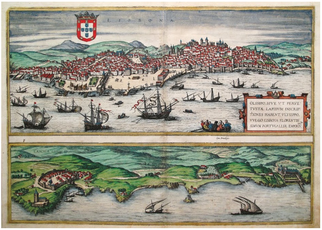
A detailed hand-drawn map of Lisbon after 425 years! We revive the artistic style of cartography of the 16th–17th centuries while creating modern panoramic city maps. We draw the same way as the cartographers of the 16th century — by hand, with black ink and watercolors.

The history of cartography is closely connected with the history of art. In ancient times cartography and art existed in close interrelation. Flemish masters of painting and cartography used the pictorial method to represent the objects of terrain. Cities, castles, monasteries, reliefs and vegetation were depicted by means of drawing and color plastics.
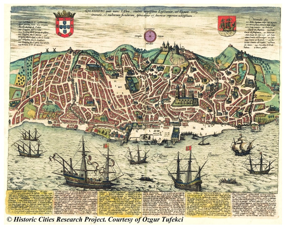
Between 1572 and 1617 in Cologne, cartographer Georg Braun and map engraver Franz Hogenberg published the first Great Atlas of Cities in six volumes under the title “Civitates Orbis Terrarum” (“Cities of the Terrestrial World”), a significant work of the age of the Great Geographical Discoveries. In it, the pictorial representation of cities is the main way of representing objects.
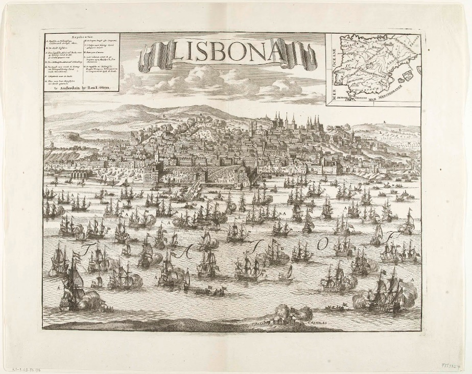
Artistic maps of Lisbon are cartographic works that often include unique, non-traditional ways of depicting the city, its history, culture, architecture and nature. Such maps can be both contemporary and historical; they can be created using both traditional cartographic methods and modern information technologies.

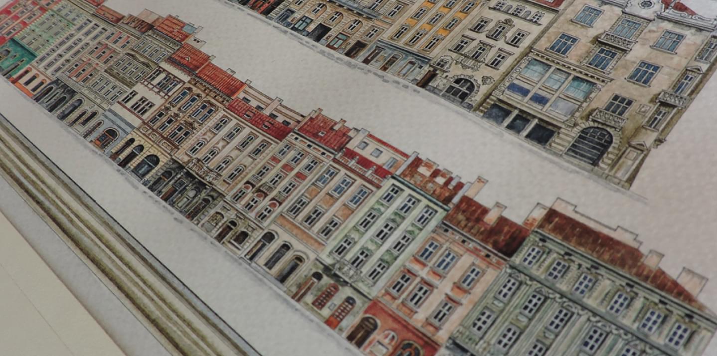
The new map of Lisbon is completed in February 2025. The panoramic map includes the entire historical part from the Tagus River side. It is made in a perspective projection developed by the author for panoramic maps of cities and takes into account the relief of the terrain. Available city plans and guidebooks of the last years of publication, video and photo materials from the Internet were used for the basis. The main source for drawing of architecture is Google Earth.
Artistic maps of Lisbon, created in different historical periods, are precious artifacts that allow us to assess the architectural, cultural and natural features of the city inherent to that time.
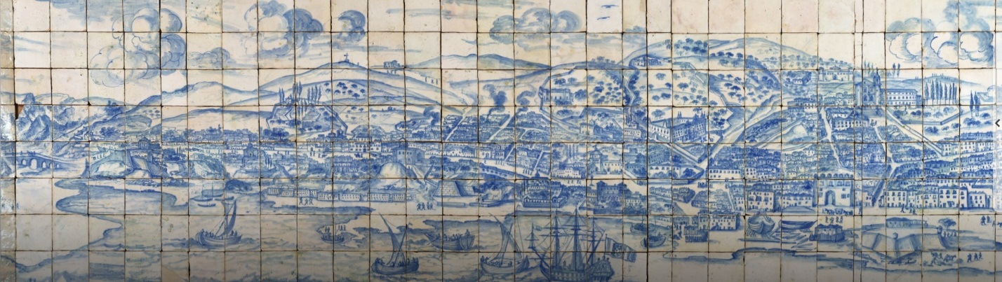
“Grand panorama of Lisbon — Alcântara and Santos” (1700) by the hand of the artist Gabriel Del Barco, executed in blue color on earthenware tiles, is a unique iconographic document. The panorama shows the most complete view of Lisbon from the Tagus River before the earthquake that destroyed the city in 1755. The work is almost 23 meters long and more than 1 meter wide and covers 14 kilometers of the coastline, depicting palaces, churches, monasteries and residential buildings, as well as the daily life of the city’s inhabitants at the time. The work is kept in the National Azulejo Museum in Lisbon.

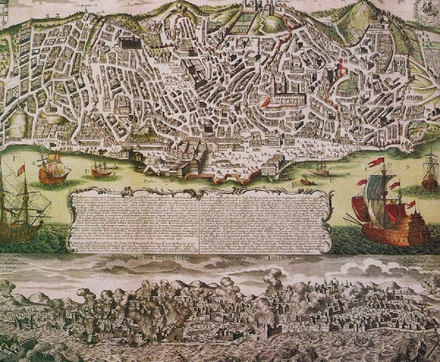
Some maps of Lisbon emphasize the historical changes that have taken place in the city. For example, a three-dimensional map showing Lisbon before and after the earthquake of 1755 may include changes in topography and infrastructure, as well as demonstrate destroyed districts and objects that were rebuilt after the disaster. This provides a unique opportunity not only to see the physical appearance of the city, but also to understand how historical events have influenced its development.
Late Medieval maps are true artistic works, treasuries, objects of art. The signs characterizing art (spiritual exploration of the world, skills of execution, etc.) are peculiar to the practical activity of cartography of this period. Maps were perceived as a means of communication between people and nature. They were often decorated with miniatures, portraits of rulers, views of cities, coats of arms, inhabitants of distant exotic countries in national costumes, hunting scenes, etc.
Modern artistic maps are characterized by a great variety in the representation of the city. Artistic techniques and cartographic methods are used for their creation.
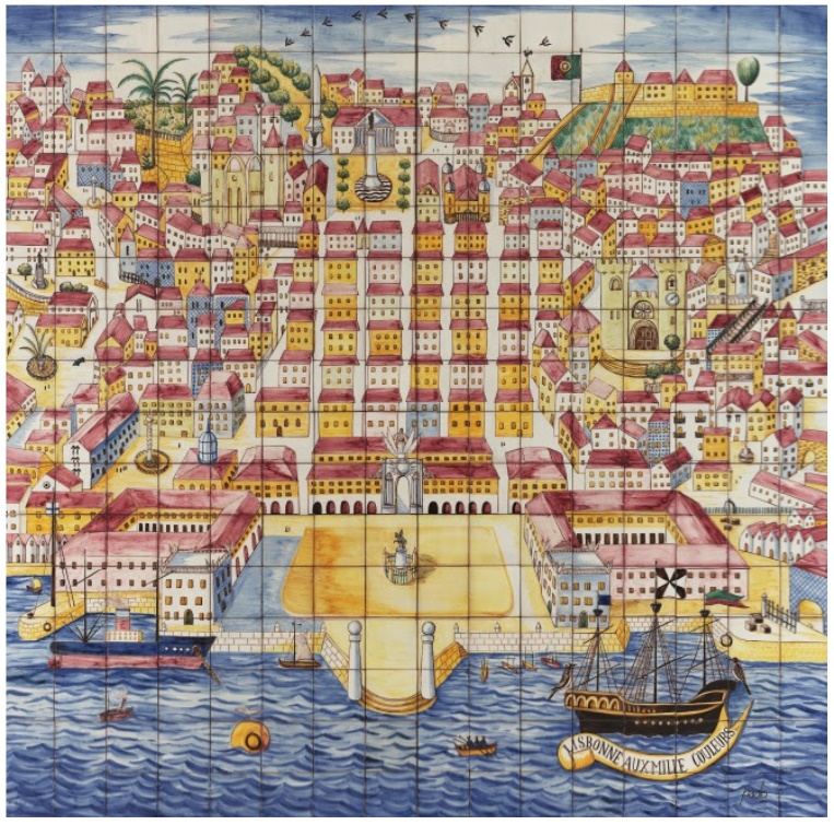
A panel in bright, abstract colors in polychrome earthenware, “Lisbonne aux mille couleurs” (1937) by Paolo Ferreira, painter, scenographer, decorator and illustrator, represents the city from the Tagus River with Praça do Comércio in the center. The 225 cm × 225 cm image was created to represent Portugal at the 1937 Paris International Exhibition under the theme “Art and Technology in Modern Life”. The panel is kept in the National Azulejo Museum in Lisbon.
Modern panoramic map of Lisbon created by hand, using a 3D overview model from the Google Earth platform. At first, the basis was made in pencil, then it was redrawn in black ink with rapidograph and colored with watercolor. Google Earth service, in addition to orienting on the terrain, allows you to select the necessary viewpoint for the map, to consider buildings from different points both zoomed in and in the surrounding space among other buildings. Also, by tilting the picture plane, you can zoom in and view the horizon line.
Enjoy the new panoramic map of Lisbon 2025!